


Channel Islands & Brittany
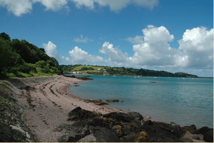
The Channel Islands are so close together that you can easily sail from one to the other within a tide. There is still time left for a little walk ashore. Because there are few ports, we often anchor and go ashore with the dinghy. The islands, according to the natives each the most beautiful in the world, differ enough from each other to take a brisk walk every day. If an island is already quite full, the coast is often still rough and unspoiled. The Vikings already knew, the best way to do tourism is with a ship. You sometimes want to sail longer than one tide and when you have arrived in Northern Brittany, you immediately notice how intensively people enjoy the summer there. The coast and especially the small French islands have a higher level of paradise than the English ones, where things are a bit more stuffy.
The navigation seems nerve-racking at first with those strong currents and all those rock formations . Yet it works very simple, provided a good map, a ruler and reasonable visibility. There are very exciting routes, but then you have to be able to rely on the engine. Being on holiday with a traditional ship in this area gives our guests a good entrance to these islands. Our ship is a welcome guest because of its contribution to a living historical image.